
A chart map built for South Florida water
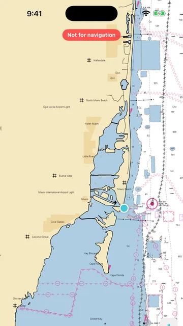
Floundr puts the official NOAA nautical chart on your iPhone, centered on where you are, so you can read channels, markers and soundings before you leave the dock.
What you get
Available now
- NOAA Office of Coast Survey chart as the base map, from Miami and Biscayne Bay to the Keys and Southwest Florida
- Your position on the chart, with long-press to save a spot exactly where you tapped
- A clear “Not for navigation” label on every map
Coming soon
- Seafloor relief shading built from NOAA's high-resolution coastal elevation models, so ledges, holes and drop-offs stand out
- Depth colors and depth contours you can switch on and off
- Download an area for offline use: frame the water you fish and save it to your phone before you lose signal
- Bahamas coverage from the GEBCO global grid (coarser: shows banks and drop-offs, not individual reefs)
Who it's for
Anglers who want to scout new water at home, and captains who want a quick second look at the chart on their phone. Floundr is a planning tool, not a chartplotter.
Free for 3 months, then $3.99/month or $29.99/year. Floundr is not for navigation. Use official charts and instruments.
More Floundr features
Questions
Are these official charts?
The base map is NOAA's own nautical chart service. It is still not a substitute for your chartplotter or paper charts: Floundr is not for navigation.
Does the chart cover the Bahamas?
NOAA charts cover US waters only. Bahamas coverage will come from relief data with a land outline, and the app will say so.
Join the Floundr beta
Floundr is in beta on Apple's TestFlight. Leave your email and we'll send you an invite to try the chart map, spots and coordinates now, and each new feature as it lands.
- Free for 3 months, then $3.99/month or $29.99/year.
- Built for South and Southwest Florida ocean waters, the Florida Keys, Florida Bay and the Dry Tortugas, plus the Bahamas
- Your spots and logs stay on your phone and your own iCloud